
Here's How the HB717 District Court Districts Divide Communities (NC)
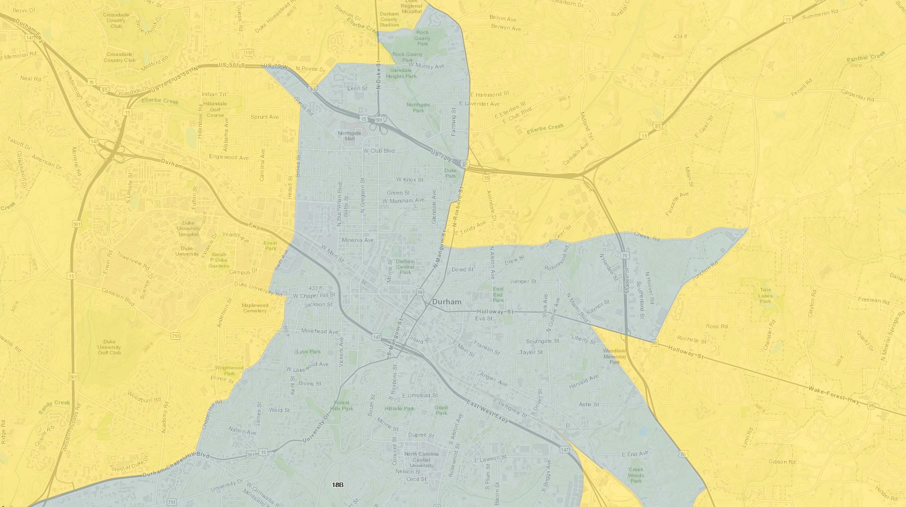
If you live in one of North Carolina's eight most populous counties (and evidently about 40% of North Carolinians do), your county may soon be divided in a new way. All of these counties currently have a single District Court district, but the proposed House Bill 717 would split each of these counties into at least two districts.
On the 11x17" PDF map provided on the NCGA website, the counties are literally the size of a postage stamp, and there are no labels for roads or municipalities or waterbodies, making it hard to tell where these lines split up towns, neighborhoods, etc.
The interactive map below, also available here, allows you to zoom and navigate and see the familiar landmarks, see where these proposed boundaries fall in relation to significant entities on the ground.
Do you see any surprising splits, like the Duke University campus, shown in the banner image at the top of this post? I'd love to hear.
I plan to provide a similar map for the proposed Superior Court districts, which are slightly different. I also plan to post some statistics about how these proposed districts differ from the existing ones. If there's other information you're curious to learn about these, please drop me a line at blake@districks.com or on Twitter, using @districks.