Some Figures About HB717's Proposed District Court Districts

Not having seen any coverage of the details of HB717's proposed changes to the judicial district maps, I thought I would investigate and post some myself.
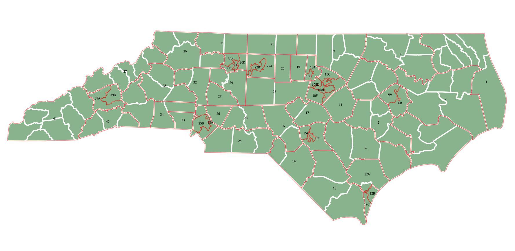
The figures below the graphic relate to the District Court Districts maps (simplified rendering of the proposed map below).
| Existing | Proposed | |
|---|---|---|
| Number of districts | 43 | 55 |
| Number of split counties (split in two unless otherwise specified) |
2: Union, Vance |
9: Buncombe, Mecklenburg, Forsyth (4), Guilford, Durham, Wake (4), Cumberland, Pitt, New Hanover (3) |
| How they're numbered | 1-30 (then suffixed with A,B,C, etc. for divisions) | 1-41 (with A,B,C suffixes for divisions – ONLY within one county) |
| Range of size | Ranging from a fraction of one county (x3) to seven counties | Ranging from a fraction of one county (x22) to seven counties |
| Range of number of judges | From one (20B) to 21 in Mecklenburg | From two (e.g. 6A, 30B) to 11 (25A in Mecklenburg) |
| Total number of judges | 271 | 272 |
| Average number of judges per district | 6.3 | 4.9 |
| Median number of judges per district | 5 | 5 |
| Number of split precincts | 3 | 3 |
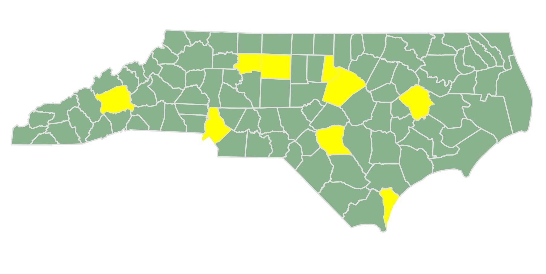
Map showcasing the divided counties below:
Here are some of the questions that came up for me related to these numbers:
- Of the nine split counties, eight are the most populous in the state (all except Pitt, which ranks 14th). Why was Pitt split, but not Union, Gaston, Cabarrus, Onslow, and Johnston, all of which have more people? And further, why are Onslow and Union lumped together with other counties?
- Why is Forsyth split into four districts, but Mecklenburg (almost three times the size) split into just two?
- In Pitt and Durham counties, both divided in two, the districts with more people (6A and 18A, respectively) are shown as having fewer judges – why?
I was hoping to do more analysis of the political data in the stat pack, but question whether I'll be able to do so before the committee meeting tomorrow afternoon.


